TIONESTA ENVIRONMENT
Climate
The climate of the Tionesta Area is cool and humid. The average annual precipitation is 42 inches, of which 16 inches falls between June and October. The average annual temperature is 46°F., and the average summer temperature is 66°F. The length of growing season is about 123
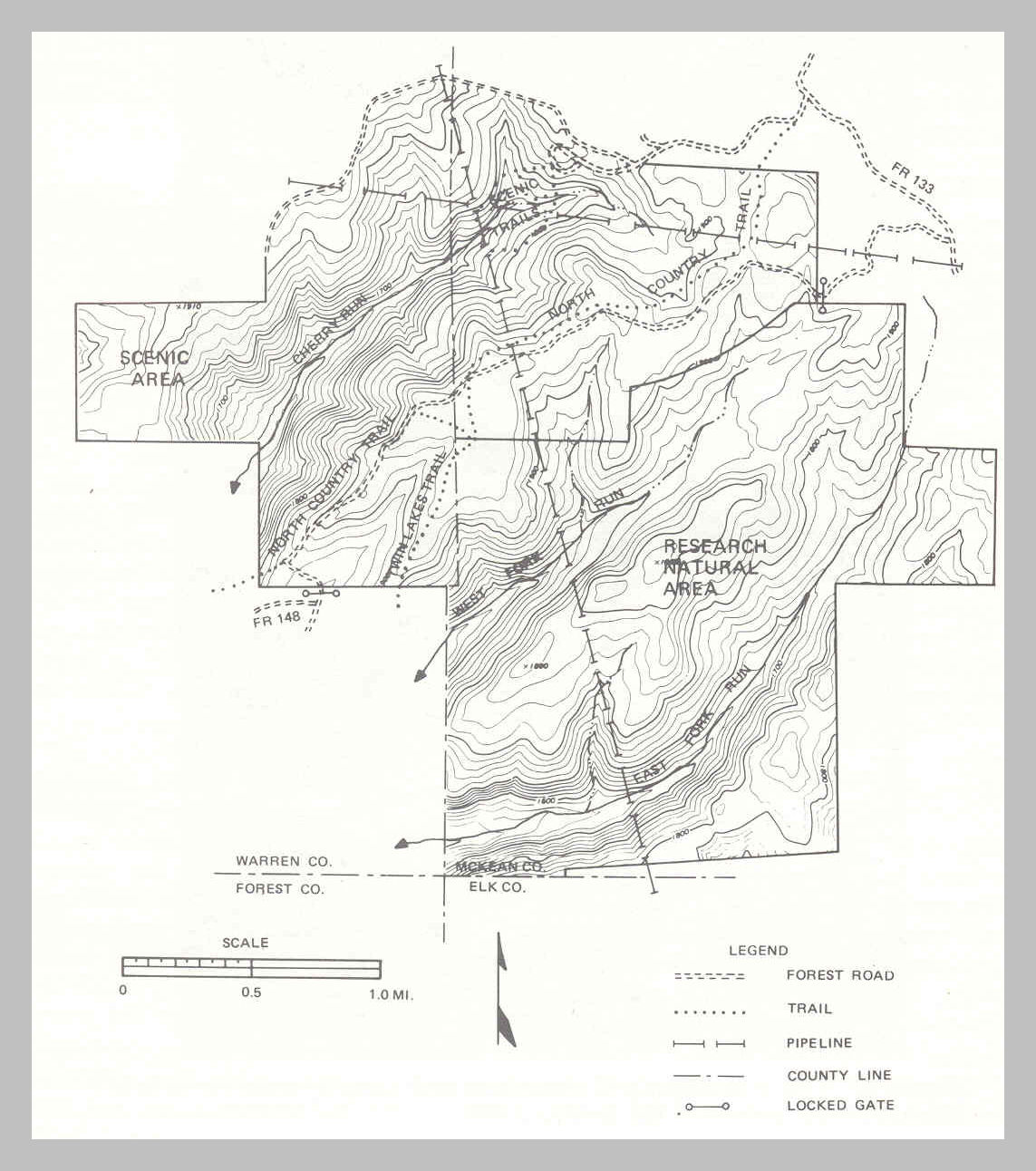
Figure 4.- The topography of the Tionesta Scenic and Research Natural Areas. The contour interval is 20 feet.
Page 3
days. The average date for the last killing frost in the spring is 25 May, and the first killing frost in autumn is 25 September.
Topography
The Tionesta tract lies within the northern part of the unglaciated Allegheny
Plateau. The topography is typical of plateaus: it has flat uplands and
steep-sided V -shaped valleys cut by streams. Elevations range from 1,500
feet above sea level in the stream bottoms to about 1,960 feet on the plateau
tops (fig. 4).
The area is drained by the Cherry Run and Fork Run branches of Tionesta Creek,
which flows southwest into the Allegheny River.
Soils
The soils are derived from the Pottsville sandstone and conglomerate that cap
the Plateau and from shales and sandstones on the slopes (fig. 5). In
general, these are very stony and extremely stony loams or sandy loams. They are
strongly acid-pH 5.1 to 5.5.
The major soil types in the Tionesta tract are
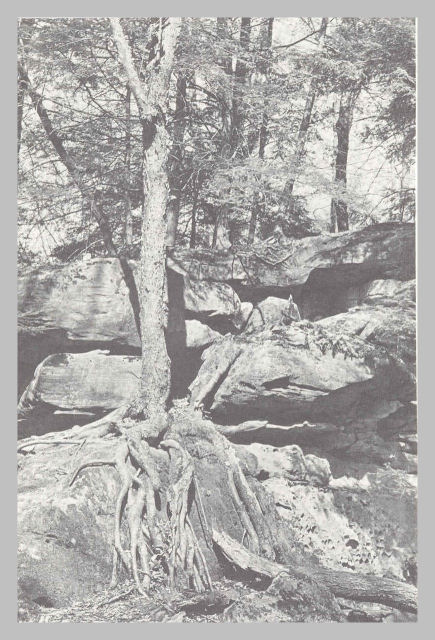
Figure 5.- This outcropping of sandstone and conglomerate rocks is in the southwest corner of the Scenic Area.
Page 4
Hazelton sandy loam, Cookport sandy loam, and Cavode silt loam. These
are residual soils, and all are found in both plateau and slope positions.
Hazelton series are deep (at least 40 inches to bedrock) well-drained soils
developed from sandstone. The water table, where present, is
normally below 4 feet.
Cookport series, formed from sandstone, are deep, moderately well drained to
somewhat poorly drained. However, during wet periods, they have a seasonal
high water table influenced by an impermeable layer 18 to 36 inches below the
surface.
Cavode series are deep but somewhat poorly drained soils formed from acid
clay shale. They have a seasonal high water table within 6 to 18 inches of
the surface during wet periods.
Despite the differences in soil drainage among these soils, the forest
vegetation does not differ visibly from one soil type to another.
Page 5